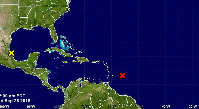
The 12 a.m. Wednesday weather update from the St. Vincent and the Grenadines Meteorological Service states that Investigation by reconnaissance aircraft this afternoon indicated that the strong tropical wave to the east of Barbados has not yet become a tropical depression.
However, the system is producing winds near tropical storm force and the accompanying thunderstorm activity remains reasonably well organized. Environmental conditions are conducive for continued gradual development, and a tropical depression or tropical storm could still form by early (today) Wednesday.
Based on analysis of satellite imagery during the past few hours, the system appears to be taking a more west-northwesterly track at about 15 to 20 mph or 24 to 32 kmh. On this track, most of the stronger winds and deeper convection should pass north of the island on Wednesday into Thursday.
Regardless of tropical cyclone development, some pockets of moderate to heavy showers, periods of rain, thunderstorms and occasional gusty winds are expected to spread across the island today, Wednesday into early Thursday.
Rainfall accumulations of 3 to 5 inches (75 to 125 millimeters) are possible, with isolated higher amounts in elevated areas. Sea swells of 3 to 4 meters (10 to 13 feet) are expected in open water. This means the warning for small craft and sea bathers will remain in effect.
The National Emergency Management Organisation (NEMO), through the Meteorological Office will continue to monitor this system.
(NEMO)


