



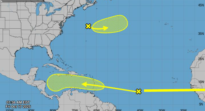

The St. Vincent and the Grenadines Meteorological Services said Friday that it continues to monitor the progress of an approaching tropical wave located near 40 degrees west, more than 1,000 miles east of the Windward Islands.
“There is a large area of showers and thunderstorms embedded within this wave and the NHC (National Hurricane Centre) has indicated that there is a low chance (10% during the next 48 hours and 30% the next seven days) of tropical cyclone development for this feature,” a bulletin said.
Regardless of development, this system is likely to generate cloudy skies and trigger moderate to heavy showers and thunderstorms across St. Vincent and the Grenadines late this weekend — Sunday into Monday.
Model guidance suggests that rainfall accumulations of 50 – 75 mm (2 – 3 inches) with higher amounts in mountainous areas are possible.
In addition, strong surface winds will accompany the system, agitating the coastal waters across SVG.

Flash flood watches or warnings may come into effect as this wave edges closer to SVG, the bulletin said, adding, “Residents are strongly advised to keep informed on the progress of this wave.”