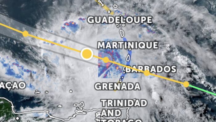
The hurricane warning for St. Vincent and the Grenadines has been downgraded to a tropical storm warning.
Dangerous storm force winds are still expected, forecaster said at 2 p.m., as much of St. Vincent remained without electricity from around noon.
A tropical storm warning in this case means that tropical storm conditions are ongoing within the warning area.
At 5 p.m., the centre of Hurricane Elsa was located near latitude 14.2 degrees north; longitude 63.7 degrees west, or approximately 180 miles (290 km) west northwest of St Vincent & the Grenadines. Maximum sustained winds are near 85 mph (140 km/h) with higher gusts.
Hurricane-force winds extend outward up to 25 miles (35 km) from the center and tropical-storm-force winds extend outward up to 140 miles (220 km).
The estimated minimum central pressure is 991 mb (29.27 inches). Movement is toward the west near 30 mph (48 km/h).
Sustained surface winds between 35 to 55 mph (56 to 89 km/h) with higher gusts are expected to spread across St. Vincent and the Grenadines this evening with light rain and pockets of intense showers and thunderstorm activity.
Rainfall accumulations of at least 3 to 6 inches (75 to 150 mm) are possible with isolated higher amounts by tonight. Further accumulations of 2 inches (50mm) are likely by Saturday night.
This rainfall could cause life-threatening flash floods and mudslides.
Residents in areas prone to flash-flooding and landslides or near rivers and streams should be prepared
Large northerly to south-easterly swells peaking near 5 metres (16 feet) are also forecast to accompany the system. Low-lying coastlines around the islands will be particularly vulnerable at times of high tide. High tide occurred at 1:01 p.m. today, Friday.
Large waves and dangerous rip tides can be expected. These will create unsafe conditions for small-craft operators and fishermen. A High-Surf Advisory and Small-Craft Warning are in effect until 12 noon, on Sunday.


