By Kenton X. Chance
CASTRIES, St. Lucia (CMC) — Caribbean countries are being told that 2025 is likely to be another year of climate extremes with regional forecasters noting that 2024 has been a year of extremes in keeping with their forecast earlier in the year.
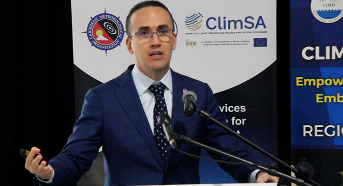
Speaking at the 2024-25 Dry Season Caribbean Climate Outlook Forum (CariCOF), climatologist at the Barbados-based Caribbean Institute for Meteorology and Hydrology (CIMH), Cédric Van Meerbeeck said that conditions are ideal for 2025 to be another successive year of climate extremes in the region.
He said the temperatures have been record high for most of 2023 and this year both in the ocean and in the atmosphere, adding that ocean heat gives climate predictability for the next season.
“We are very well able to forecast the change in the amount of heat in the ocean, and therefore, in some cases, we are quite confident in forecasts of our climate conditions,” he said.
He noted that a graphic depicting land and ocean temperature percentiles in October 2024 from the US-based National Oceanic and Atmospheric Administration’s National Centers for Environmental Information shows various shades of red.
“Dark red means it’s been record warmest in … October. Reddish means it’s still been much warmer than average,” Van Meerbeeck said.
“I hope you can all see — and it’s not just my glasses — that there has been near record warm pretty much everywhere,” he said, adding that while regional forecasters are mostly concerned with temperatures in the Atlantic Ocean, the Pacific Ocean is also a consideration.
He said the Pacific began the year with El Nino, which added a lot of heat into the atmosphere.
“And now we transitioned into its cold counterpart in the Pacific, hopefully not a strong La Nina,” the climatologist said, adding that La Nina conditions have the opposite effect on the Caribbean climate.
“El Nino is a driver of drought, is a driver of increasing temperatures over the year, and is a driver of reduced tropical cyclone activity. La Nina is the opposite.”

He said that in the Atlantic Ocean, from where most of the energy to form Caribbean weather systems comes, “temperatures are still record warm and still expected to remain near record warm.
“So we have still near record warm heat in the next season in the Atlantic, and that is exactly what brought us a year of extremes in 2024,” Van Meerbeeck said, noting however there are some unknowns as some variables are unpredictable or cannot be forecast on a seasonal timescale.
“And one of those unknowns that has been an unknown also before the hurricane season, is how often does dry air from the Sahara, which often brings us dusty conditions, … stifle shower activity in the Caribbean.”
He said that while forecasters cannot forecast Saharan dust more than two weeks in advance, historical averages indicate that the peak of the dust season is between May and July.
Intense 2024 wet/hurricane season
The climatologist said the 2024 wet/hurricane season was intense, especially the latter part of the season.
“… and we’re expecting it to be prolonged by several weeks, so at least until the end of the year, including Christmas,” he said and reminded the forum of the 2013 Christmas Eve floods.
“Let’s be on the lookout for weather. Please keep monitoring so that it doesn’t take you by surprise.”
He said that in the dry season, the northwest Caribbean — Bahamas, Cuba, Cayman Islands, and to a certain extent the Greater Antilles– “need to be on the lookout for the driest conditions of this dry season”.
The chance of flash floods and flood-producing extreme rainfall will sharply increase towards the end of the dry season.
Van Meerbeeck said that while some Caribbean residents are yet to be familiar with the term “heat season”, this is a reality in the region.
“… but from April or May until October, we now have a heat season. That heat season is when our heat waves occur,” he said, adding that the 2024 heat season started early.
“… for next year, it’s expected to start early again. It used to be only one or two months brought heat waves back in the 90s. Then it became six months in the 2010s. Now we’re already at seven or eight months. That’s the flavour of climate change in the Caribbean,” Van Meerbeeck said.
9 categories of hazards
He said the CIMH, regional met services and their other partners monitor nine categories of hazards.
These are tropical cyclones, pluvial/riverine flooding, surging/coastal flooding, excessive dryness, fire weather, excessive heat, coral reef bleaching, Saharan dust intrusion, and Sargassum beaching
“… hazards occur all year round. And we can prepare, and we should prepare for that.”
The climatologist said the most rampant hazards in the dry season include the obvious effects of excessive dryness including short- and long-term drought.
“But we’re also thinking recurrent dry spells, which are deleterious to crop growth in particular parts of their crop cycle. We’re thinking fire weather,” he said, adding that excessive dryness and fire weather are expected to be maximum around March.
“But then, depending on how often we’re going to get dust, after that, the dryness could continue a bit longer,” he said referring to Saharan dust intrusion.
Van Meerbeeck said that if dust intrusion comes less often than usual, the wet season is expected to come in “a little bit quicker”.
He said the heat season normally starts around April or May, adding that there were a number of heatwaves in March and this might be repeated in 2025.
“… so that leaves us with a cool season that’s only three months long, and even that season will be warmer than usual, probably, but at least more comfortable.”
Van Meerbeeck said this might not be good for crops like tomatoes, which need a lot of contrast between nighttime and daytime temperatures.
“But it will still be more comfortable for our health, less dangerous.”
Meanwhile, Van Meerbeeck noted that coral reef bleaching reacts to heat in the ocean, adding that the heat in the ocean takes time to accumulate.
“So even though the ocean temperatures are finally starting to go down a little bit, coral reef bleaching will still continue for another month or so.”
Van Meerbeeck pointed out that Sargassum beaching has become a hazardous condition since 2011.
“… right now, the good news is there’s virtually no Sargassum in the western tropical Atlantic, but there are big mats of Sargassum looming in the eastern Atlantic,” he said.
“The question is, ‘Are they going to come across and lead to a big bloom season next year or not?’ We don’t know yet. So there are some things we will come to know in the next few months.”

CIMH 2024 outlook accurate
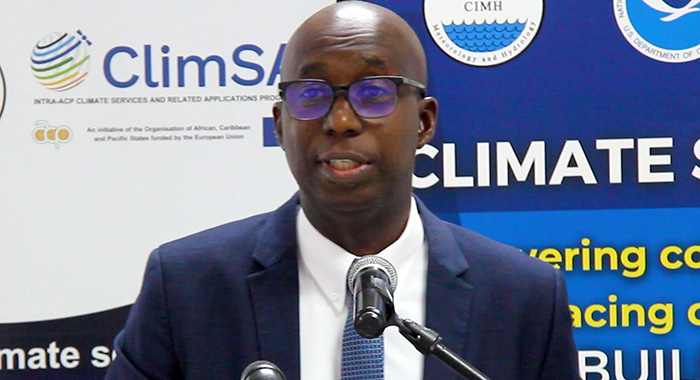
Meanwhile, CIMH agrometrologist Adrian Trotman, told the forum that the regional institute was accurate in its outlook for the 2024 wet and hurricane season
“… these seasons offer two totally different challenges to the region. You can imagine that when we say … wet and hurricane season, the hurricanes tend to stand out.
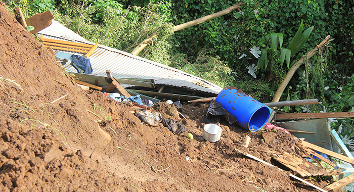
“But if you ask some people in St Vincent and the Grenadines, Grenada, Trinidad and Tobago in recent times, doesn’t have to be a hurricane to be horrific,” Trotmas said, referring to the heavy rains that trigger landslides and flooding in those southeastern Caribbean nations.
“… we’re nearing the end of a very interesting year — 2024. As the year 2023 was approaching its end and into early 2024, we dubbed 2024 as a year of extremes.
“It started early in the year with that challenge of the dry season, where in some parts of the Caribbean, it was even drier than normal.”
He said the region prepared for three significant climate challenges as the wet and hurricane season.
“The one that followed us from last year was nothing to do with wet, nothing to do with extreme winds, but heat …” Trotman said, adding that air conditioning units and fans sold out in some countries, where fans were “just blowing hot air”.
“Even during the cooler season, it felt sometimes uncomfortable, and that cooler season seemed to end earlier than we would have hoped.” Trotman said 2023 was “a record year temperatures, and word is that 2024, up until November, is challenging 2023 to be the new record.
“Were we prepared despite being warned?” Trotman said, adding that as mid-November approached, some Caribbean residents might have been asking about the extreme hurricane season that had been forecast.
“… some people were lucky to escape Beryl. Some of us weren’t. But certainly, if you ask persons in the western portions of the Caribbean in particular, including Florida, they don’t share your voice at all.
“For them, it was a horrible season, and we did reach within that range of extreme that we refer to in our forecast. So it was an extreme hurricane season. We were much luckier in this part of the world because of the way things petered out with respect to the timing,” Trotman said.


I AGREE with your forecast that it will be so Extremely hot 🔥 it will feel like hell itself.