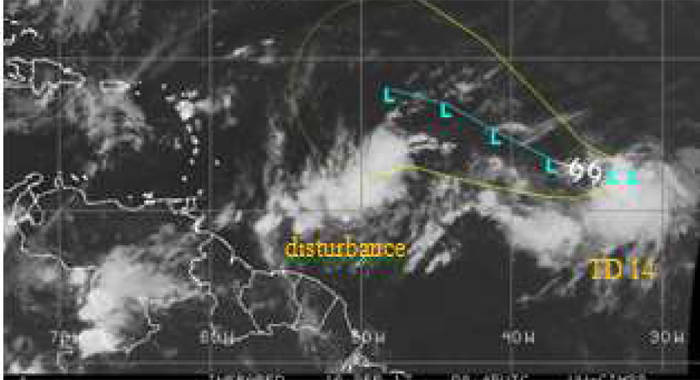
The St. Vincent and the Grenadines (SVG) Meteorological Service on Saturday said it continues to monitor two areas of low pressure in the Atlantic Basin.
Tropical Depression #14 is located near 12.6°N 32.1° west, moving westward at 7 mph away from St. Vincent and the Grenadines.
Closer to the islands is a strong tropical wave (disturbance) in the central Atlantic.
The disturbance is about 800 miles east of the Windward Islands; associated showers and thunderstorms have become better organised. There is a high (90 per cent) chance for development today (Saturday) or Sunday as it tracks westward to west-northwestward near 20 mph.
By late Sunday, increasing cloudiness followed by moderate to heavy showers, periods of rain, scattered thunderstorms and occasional gusty winds are likely across SVG.
Rainfall accumulations exceeding 8 inches (200mm) are possible with the passage of the system. A flood warning may be required at short notice.
Gentle breeze Sunday afternoon should increase by evening to moderate, becoming northerly overnight. Strong breeze could increase to high wind/near gale 25-33 knots (47- 61 kmh) by Monday night over portions of St. Vincent. Strong westerly breeze Tuesday and Wednesday as system pulls away from SVG.
Seas are expected to rise to moderate by Sunday afternoon on east coasts, with sea swells peaking near 4 meters (13feet) by Monday, with northerly swells by Monday evening across SVG.
Breaking wave action will pose a threat to life and property within the surf zone. Large waves and dangerous rip currents can be expected, becoming more adverse at times of high tide. A High-surf Advisory and small-craft warning may be issued from 6 p.m. today.
Forecasters have urged all residents to monitor the progress of this system.
Tropical storm or hurricane watches could be issued for some islands later this morning.
Motorists and residents near areas prone to flooding and land slippage should take precautions.
Sea bathers and other users of the sea are advised to stay out of the water during the passage of the system.
The next statement/advisory will be issued at 12 noon today or earlier, if necessary.


